The Shire
Homeland of the Hobbits
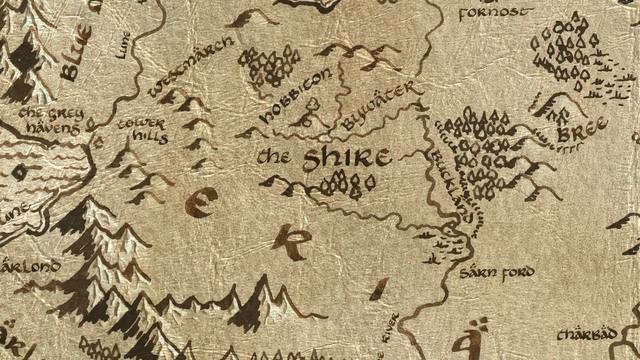
A fertile, well-ordered region in Eriador settled by Hobbits in TA 1601 when the brothers Marcho and Blanco received a land-grant from King Argeleb II of Arthedain. Bounded by the Brandywine River to the east, the Far Downs to the west, and roughly the East Road to the south, the Shire was divided into four Farthings — North, South, East, and West. Its chief town was Michel Delving on the White Downs, seat of the Mayor. The Shire's pastoral peace was quietly maintained by the Rangers of the North — Dúnedain who guarded its borders without the Hobbits' knowledge. After the War of the Ring, King Elessar made the Shire a Free Land under the protection of the Northern Sceptre and forbade Men from entering it.
Figures: Bilbo, Frodo, Sam, Merry, Pippin, the Thain, the Mayor
| Place | The Shire |
|---|---|
| Book | Appendices |
| Date | Third Age 1601 |
| Map x, y | 2772, 1258 |
What this connects to
- Bag End — Where the story begins
- Mount Gram — Battle of Greenfields (leading here)
Routes passing through
5 traced routes run within 150 map-pixels of here:
- Bilbo's Journey
- Frodo's Journey
- Merry & Pippin's Journey
- Gandalf's Journey (Hobbit)
- Gandalf's Journey (LOTR)
Nearest places on the map
- Bywater — 135 map-pixels away, Third Age 3019
- Bag End — 143 map-pixels away, Third Age 3001
- Bag End — 145 map-pixels away, Third Age 2941
- Michel Delving — 168 map-pixels away, Third Age 1601
← Argonath
Michel Delving →
All 119 places · the map · the timeline