White Mountains
Ered Nimrais
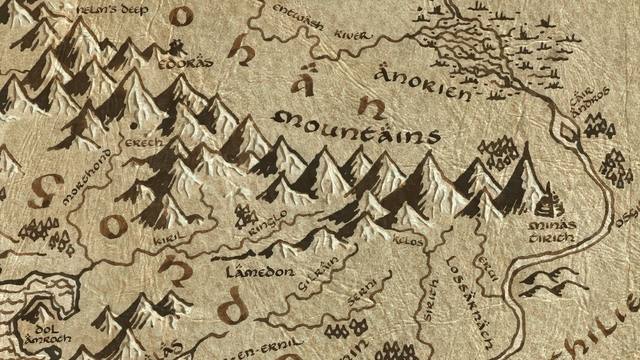
The great mountain range running east to west between Rohan and Gondor. Beneath its peaks lie the Paths of the Dead, and along its northern feet stand Edoras, Dunharrow, and Helm's Deep. Its eastern end overlooks Minas Tirith and the Pelennor Fields. The beacons of Gondor are lit along its summits to call Rohan to war.
Figures: Théoden, Aragorn
| Place | White Mountains |
|---|---|
| Book | Appendices |
| Date | Second Age 3320 |
| Map x, y | 4253, 2607 |
Routes passing through
3 traced routes run within 150 map-pixels of here:
Nearest places on the map
- Lamedon — 227 map-pixels away, Third Age 3019
- Dunharrow — 299 map-pixels away, Third Age 3019
- Linhir — 310 map-pixels away, Third Age 3019
- Paths of the Dead — 342 map-pixels away, Third Age 3019
← Tower Hills
The Brown Lands →
All 119 places · the map · the timeline